During the North American Free Trade Agreement (NAFTA) in 1992, Mexican government officials voted for a constitutional amendment to article 27, now enabling the incorporation of 103.2 million hectares of former communally owned agrarian land into the national real estate market.
The Mexican government thus promoted the urbanization of agricultural land—so far ignored by spatial practices—on the outskirts of most Mexican cities. In partnership with North American investments, federal and state officials encouraged the settlement of a new wave of industrial manufactures and privately owned single-family houses for the working class in the center of Mexico. Accelerated by this policy, most agrarian rural landscapes in the outskirts of urban cores transformed into a pattern of asphalt roads and enclaved clusters of single-family units prioritizing private—high carbon emission—mobility to access them.
After studying this scenario, we closely collaborated with Desarrollos Vivitare (DV) to develop the following urban and housing prototype. In the past, the work of DV followed the classic strategy used by large-scale developers—such as DV—to provide affordable housing. Developers with access to extensive pieces of land accumulate and assemble former communal agrarian land to—following the zoning ordinance—build clusters of horizontal single-family houses.
Now, the methodologies of DV not only challenge the classic strategy. Recently they acquired an interest in using urban design and landscape architecture as tools to reflect on and speculate on the fluctuating price of land.
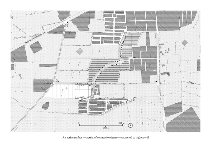
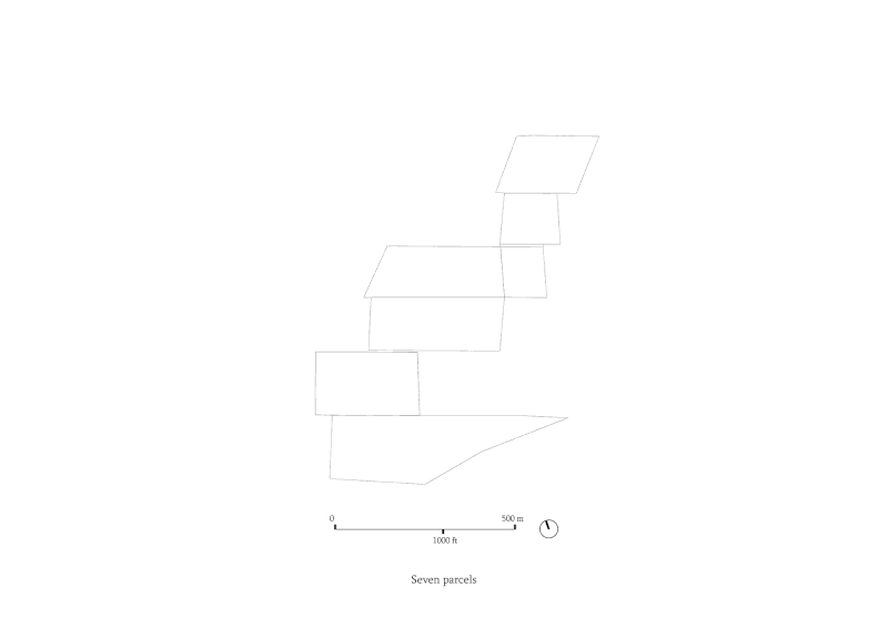
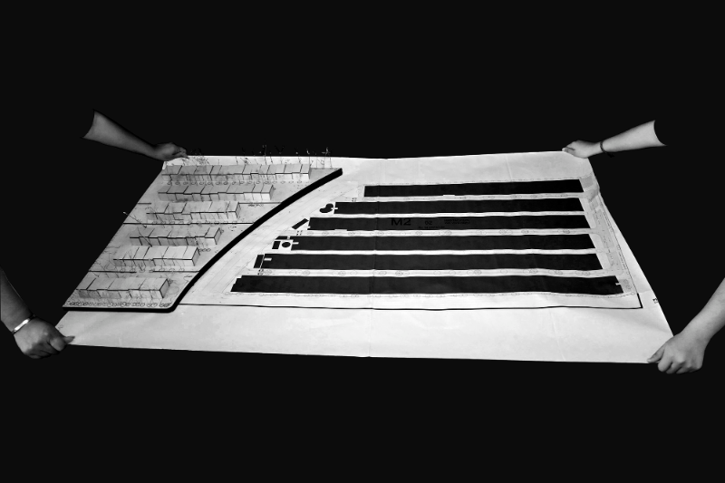
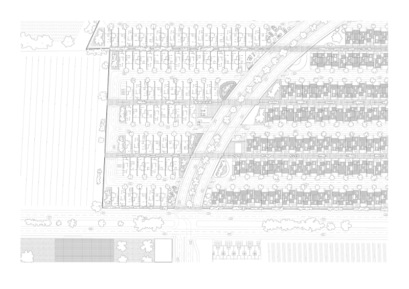
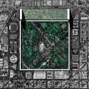
Following DV’s wishes to design the masterplan to extend (an existing project) and accommodate 1000 horizontal, affordable dwellings in 17.7 hectares—made of five patched-style farming parcels, we proposed them what landscape architect Alex Wall and OMA call a ‘programmatic active surface’—a functioning matrix of connective tissue that organizes fixed objects and dynamic processes and events that move through time— connected to freeway 45D. This large-scale ambition is pursued by phasing the development into four stages. Following land price trends coming from DV’s decades of experience, land prices during each phase of the plan will vary by capitalizing on all the previously built. Land price variations will ultimately alter DV’s building construction cost ratio, hence opening the possibility of introducing in each phase a diversified housing stock, materials, and types of dwellers.
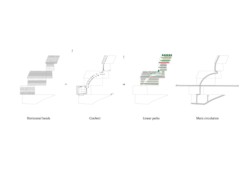
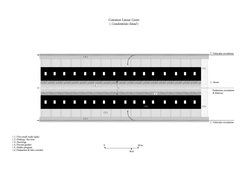
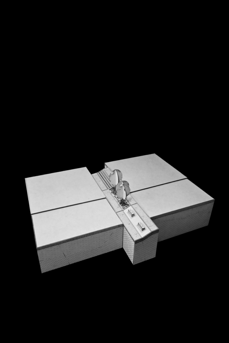
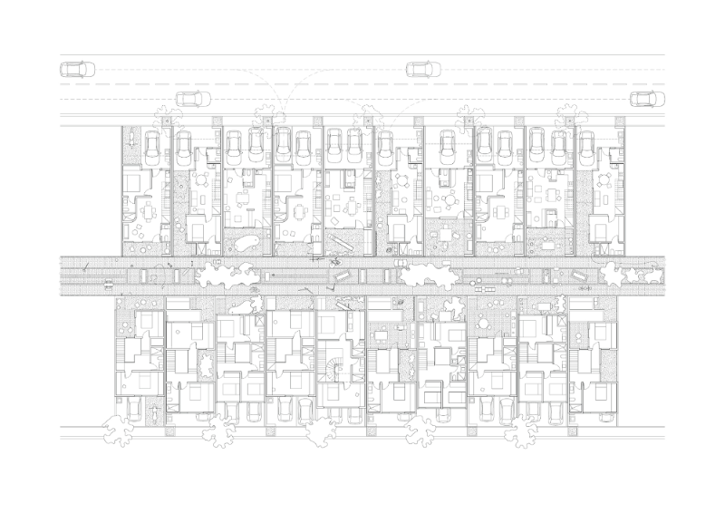
Rather than introducing our partner to alienated content, we carefully study DV’s current urban, architectural, and structural solutions to strategically reorganize and repurpose their existing design and construction cost (ratios). ( 1 ) The split divides the existing cul-de-sac into two segregated driver-oriented roads at edges of the module. On the other hand, the slipt opens the space to ( 2 ) slide-in a walkable linear corridor attached to each house yard. Thus, the split and the slide-in, organize and bind the dwellings with two types of linear circulations.
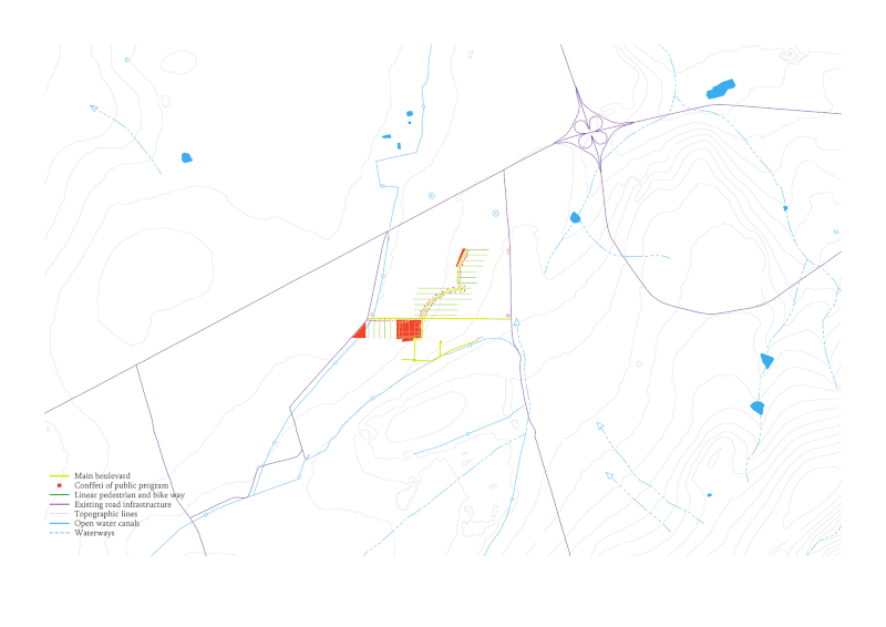
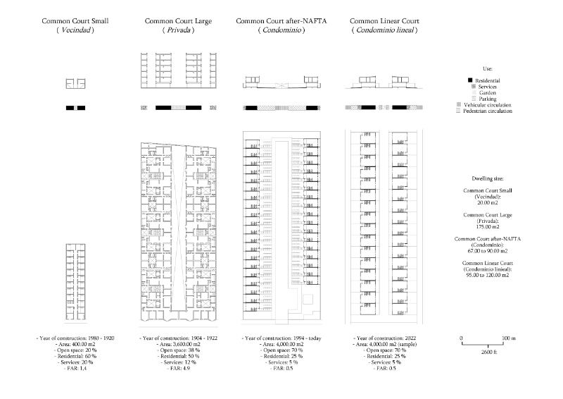
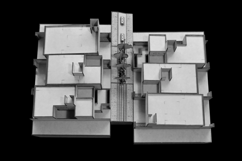
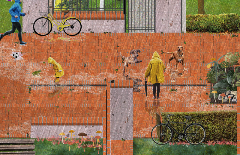
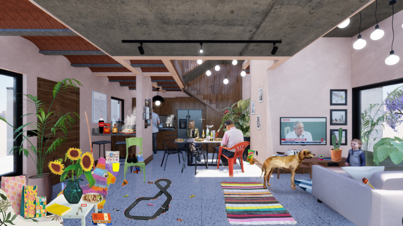
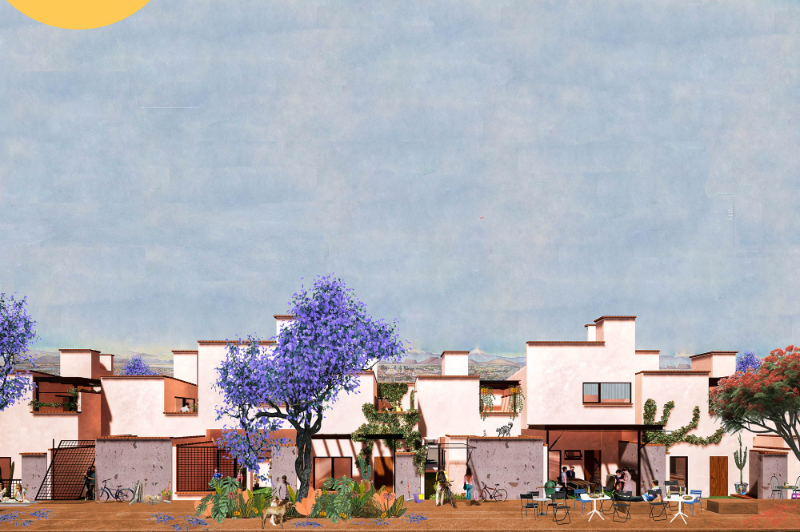
Our final master plan strategy organizes the extensive program into horizontal bands across the site. One band is oriented to driving circulation, one band is given to domestic space, and another band is allocated to walkable recreational programmatic corridors. The thickness of each band is flexible, thus making them easy to reorganize and capable of absorbing minor nuances and variations in the future. The only element that squiggles and crosses transversally through the bands is a ‘thick’ boulevard that connects all the bands through driveways, bike lanes, walkways, and rows of trees with freeway 45D. Locally, the boulevard weaves the walkable corridors with the confetti public program layer, transforming them into a series of linear walkable parks that tie the overall scheme to each dwelling’s garden.
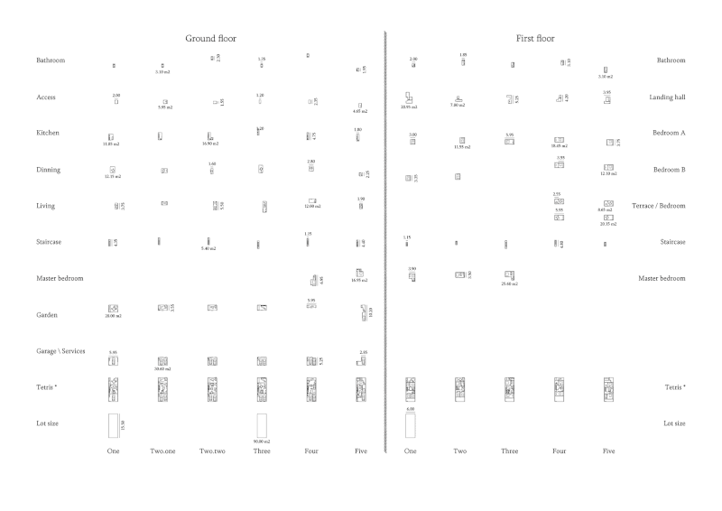
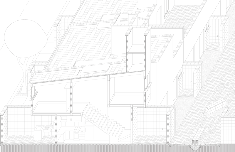
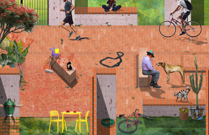
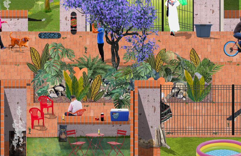
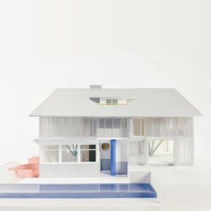
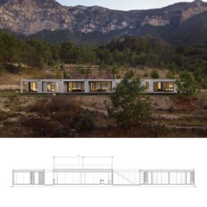
The proposal included eight single family prototypes. Each dwelling is organized perpendicularly to the masterplan bands’ orientation by using a structural service wall that contains all the houses’ fixed infrastructure: pillars, bathrooms, kitchen, vertical circulation, plumbing & electrical. The design leaves the void spaces rimmed by the wall on the ground floor for cooking, eating, and gathering. On the upper floor, residents can incrementally build, divide and reorganize private rooms and terraces as residents’ domestic needs change over time.